 CN
CN
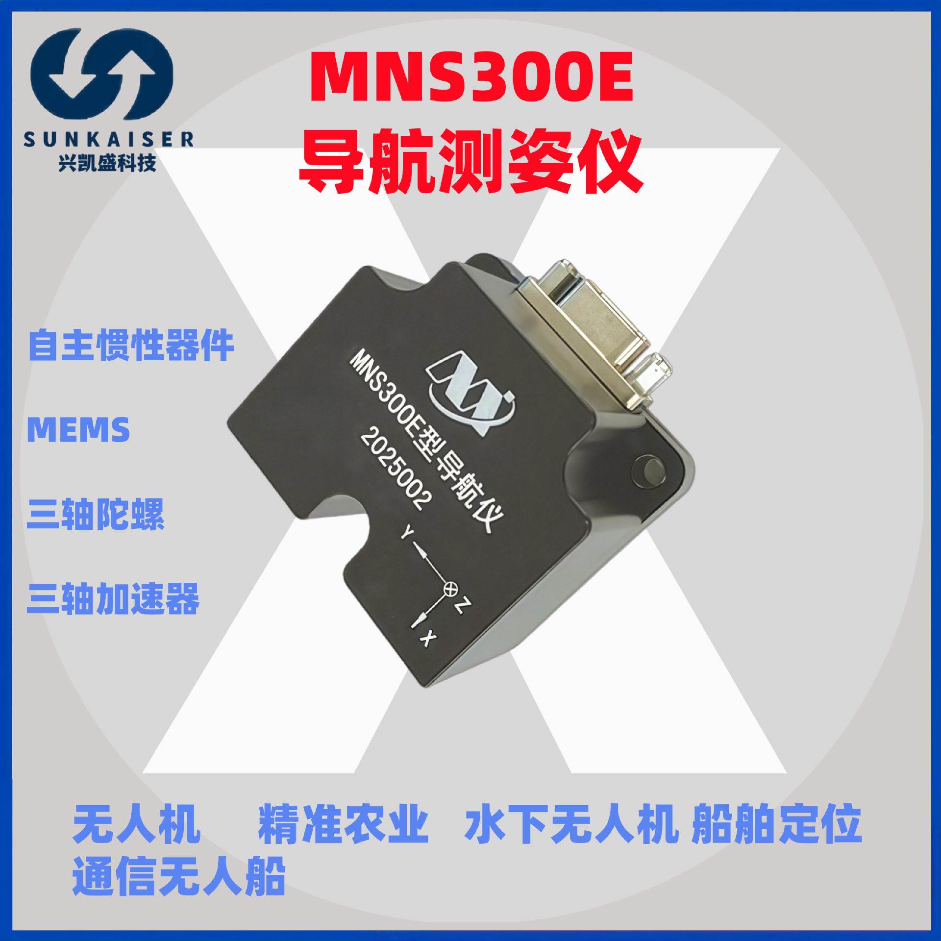
Precision Navigation Redefined: The MT MEMS INS300E GNSS/INS System
In the demanding fields of aerial surveying, autonomous navigation, and industrial automation, the accuracy and reliability of your positioning system are non-negotiable. Enter the MNS300E / INS300E from MT MEMS, a state-of-the-art GPS-aided Inertial Navigation System (INS) designed to deliver exceptional performance where it matters most. This industrial-grade IMU sets a new benchmark for integrated navigation solutions, combining high-precision MEMS technology with robust design for the most challenging environments.
Engineered as part of the renowned MNV series, the INS300E is a complete combination navigation system. It seamlessly fuses data from multi-constellation GNSS receivers with a high-performance inertial measurement unit (IMU). This fusion provides continuous, centimeter-level positioning and precise attitude data, even during temporary GNSS signal outages—a critical feature for operations in urban canyons, under dense foliage, or in other GPS-denied scenarios.
Unmatched Durability for Demanding Applications
The INS300E is built to last. With an IP68 protection rating, it is completely dust-tight and can withstand prolonged immersion in water. This makes it an ideal choice for drones (UAVs) operating in adverse weather, unmanned ground vehicles (UGVs) navigating muddy terrain, and marine survey platforms. Its rugged construction ensures reliable operation from extreme cold to intense heat, guaranteeing data integrity across your entire mission profile.
Certified Quality for Global Deployment
Quality and compliance are at the core of the INS300E's design. The system holds the CE mark, ensuring it meets EU health, safety, and environmental protection standards. Furthermore, it is RoHS compliant, adhering to strict restrictions on hazardous substances. For businesses looking to build their own branded solutions, MT MEMS offers authorizable自有品牌 (OEM) opportunities. This, combined with its status as a cross-border export专用货源, makes it a perfect, streamlined supply for your独立站 (independent store) or global distribution network.
Core Applications Driving Innovation
The versatility of the MT MEMS INS300E opens doors across numerous high-tech sectors:
- Drone/UAV Surveying & Mapping: Enables high-accuracy photogrammetry, LiDAR scanning, and topographic mapping with stable positioning and orientation data.
- Autonomous Vehicles & Robotics: Provides the critical localization and perception data needed for path planning and navigation of无人车 (unmanned vehicles) and robotic platforms.
- Precision Agriculture: Guides autonomous tractors and sprayer drones for efficient field management.
- Marine and Industrial Automation: Delivers reliable heading, pitch, and roll data for vessel dynamic positioning and automated machinery.
Your Strategic Advantage in a Competitive Market
Choosing the INS300E combination导航系统 is more than just selecting a component; it's investing in a foundation for precision. For system integrators, survey service providers, and OEM manufacturers, this system offers a turnkey solution that reduces development time and integration complexity. Its high information density output, coupled with proven reliability, allows you to focus on your core application and deliver superior results to your end-clients.
In conclusion, the MT MEMS INS300E (MNS300E) represents the pinnacle of accessible, high-performance navigation technology. It bridges the gap between costly military-grade systems and consumer-grade IMUs, offering professional-grade accuracy, resilience, and certifications. Elevate your platform's capabilities and ensure mission success with the navigation system trusted by professionals worldwide.
Keywords: MT MEMS INS300E, MNS300E, GPS INS, GNSS IMU, UAV Navigation, Drone Surveying, Autonomous Vehicle Sensor, Combination Navigation System, IP68 IMU, High Precision Attitude Heading, MEMS Inertial System, OEM Navigation Module.